
Process Information
Contact Information
Primary Contact
Angie Clarke
2024 Candidate Status
Nominated
Street Address
155 Ridge Rd
Postal Code
A1C 5R3
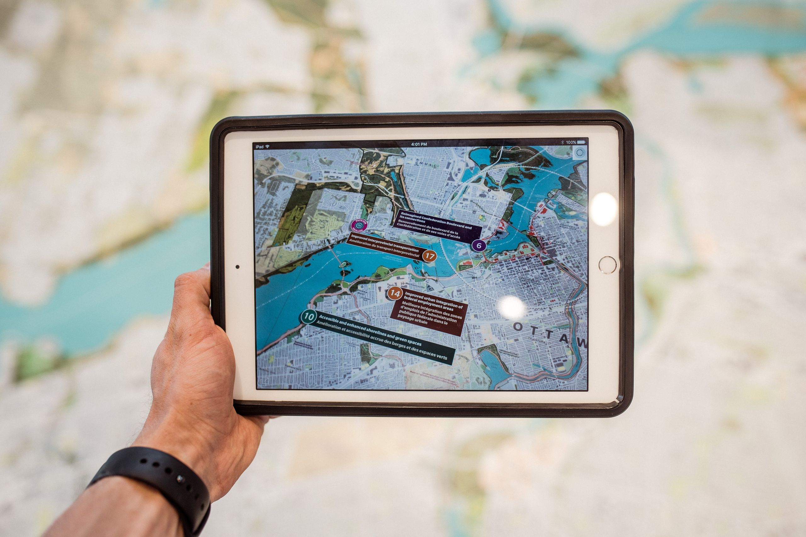
GIS Offerings
The Ocean Mapping program is designed to: Provide a solid understanding of ocean mapping technologies through practical application of marine surveying, remote sensing, oceanographic instrumentation, and Geographic Information Systems for the collection, management, analysis and dissemination of ocean data. Provide comprehensive knowledge of the theory and practice of hydrographic surveying and applied disciplines. Provide an environment to practice analytical reasoning, decision-making, problem-solving and solution development as it relates to Marine Geomatics.

Institutions that are participants in the Esri Canada GIS Scholarship program.


If you wish to contact this person and they have not provided contact information, you may send your message to scholars@esri.ca. The Scholarship Coordinator will review your message and forward it to the intended recipient if deemed appropriate.